Understanding > Astronomical calculations
Total eclipse of August 11, 1999
Presentation of the eclipse
Description of the eclipse
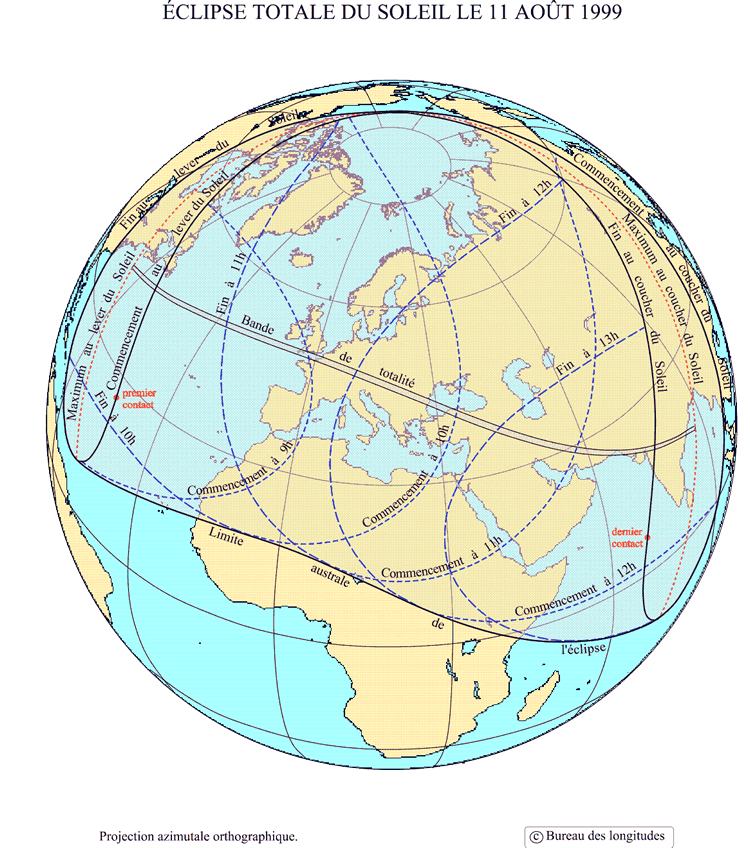
This eclipse is the last total eclipse of the XXth century. Indeed, the four eclipses of 2000 are partial. It bears the number 7631 in the canon of Oppolzer and belongs to Saros series number 145 of the canon of eclipses of Mucke and Meeus. Its central path began in Atlantic north (south of Newfoundlan), and across Europe from west to east, then Turkey, Iraq, Iran, Pakistan and ends in India.
General maps
Visualisation of the zones of visibility of the eclipse on all the Earth
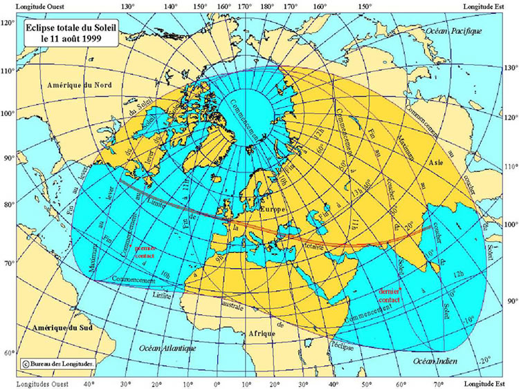
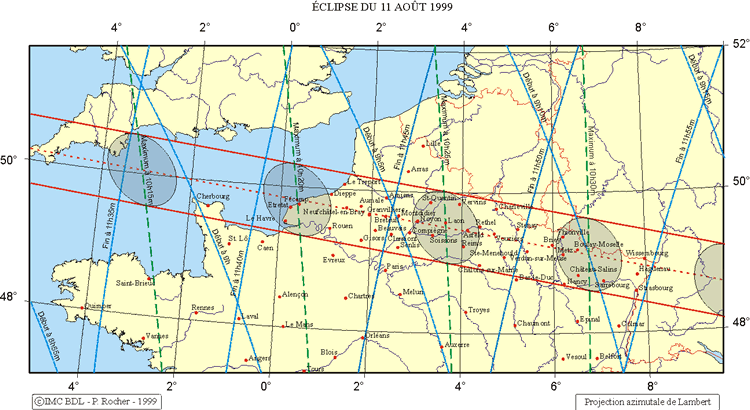
Local maps : zones of visibility of the total eclipse :
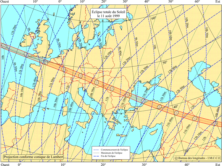
Map of visibility on France :
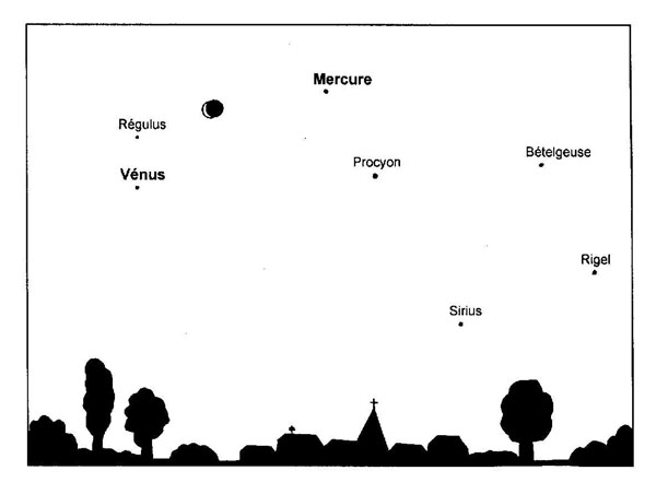
Simplified map of the sky at the time of the eclipse :